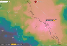
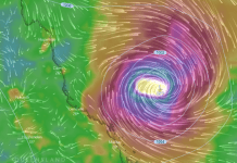
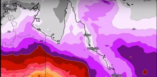
The weather video above shows different weather models showing possible scenarios from about 19/01/2021 – 29/01/2021
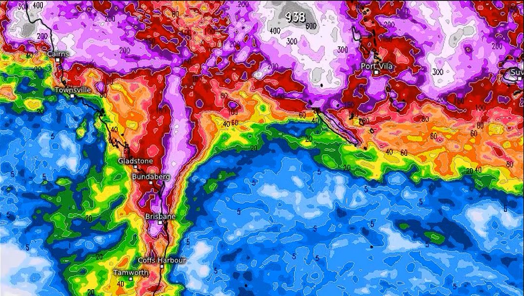
Rain and Weather Forecast 7-14 Days Outlook Queensland
Brisbane, Gold Coast, Sunshine Coast, Maryborough, Hervey Bay, Bundaberg, Gladstone, Rockhampton, Cairns, and other major centres surrounding these areas.
Multiple cyclonic and intense rain-bearing systems are likely to impact the Queensland coastline over the next few weeks, including southern Queensland and northern Queensland. The monsoon is going to kick into gear with a vengeance in the next 2-3 weeks and may be a prolonged event.
A Possible Tropical or subtropical low to head in a south-west direction toward the central or southern Queensland coastline in about 10-15 days time.
Several models are indicating a tropical disturbance in the central Coral sea may develop in several days time and head toward the Queensland coastline. At this stage, it is not known how much rain or how strong the weather system will be.
I suggested this same system developing a few days ago on my Facebook page Tims Severe Weather Queensland. Since then more models are coming into agreement.
If the system does develop and head toward the Queensland coastline, then it will be a major weather event with strong winds and squally rain periods developing along the central or southern Queensland coastline.
Regions and cities that may be affected are Rockhampton, Gladstone, Bundaberg, Maryborough, Hervey Bay, Gympie, Sunshine Coast, Brisbane and the Gold Coast.
Please take note that the forecast may change as in weather terms it is an extended forecast, but as every day progresses since my update a few days ago, it is becoming more likely.
The system could head west, south-west, or south from its development origin based on current models (as from 19/01/2021).
Latest Access-G model – shows a direct hit on SE Queensland from a strong low or a lower end Category cyclone impact. The video below shows rain intensities, pressure and wind gusts. (See Below)
Stay tuned for more updates on my weather page: Tims Severe Weather Queensland.
If you would like to know more about what is driving the current climate in Australia at the moment have a read of this article about the La Nina weather system that is currently affecting Australia’s weather.
La Ninas are a major weather phenomenon that affects large portions of the world climate when they are in effect.
They are the opposite of El Ninos. La Ninas typically bring more intense thunderstorms and cyclones and a larger number of them, they also bring more intense weather systems such as tropical and sub-tropical lows and rain-bearing systems. Especially on the Eastern Australian coastline.
El Ninos bring the opposite such as droughts, bushfires and drier weather. You can read more about this topic here: What is a La Nina and how does it affect Australia.
Also some great informative articles on past cyclones that have struck Australia including rare footage and sound files and hard to find information.
- Cyclone Tracy – The Monster Of Darwin
- Cyclone Yasi – A Category 5 Cyclone – Largest Cyclone To Hit Australia
Queensland Fire and Emergency Services advise that people should:
* Move your car under cover or away from trees.
* Secure loose outdoor items.
* Never drive, walk or ride through floodwaters. If it’s flooded, forget it.
* Seek shelter, preferably indoors and never under trees.
* Avoid using the telephone during a thunderstorm.
* Beware of fallen trees and powerlines.
* For emergency assistance contact the SES on 132 500.

- Please keep an eye on the Bureau of Meteorology Brisbane Weather radar for live storm updates.
- Also, keep an eye on the weather warnings page for Queensland.
- Be prepared for severe thunderstorms this season. Read the Bureau of Meteorology’s Preparation and safety during thunderstorms
For further information and live updates about Queensland weather forecasts visit:
- https://www.facebook.com/HigginsStormChasing/
- https://www.facebook.com/ozcyclonechasers
- https://www.facebook.com/SevereWeatherAustralia/
- https://www.facebook.com/seqweather
- https://www.facebook.com/Tims-Severe-Weather-Queensland-100157335236883/
Weather Maps and Tools
- Queensland Live Weather & Lightning Radar Map
- Queensland Live Wind & Gusts Radar Map
- Queensland Live Temperature Map
- Queensland Waves & Swells Map
Sign up to received regular emails about new articles the might interest you.
Your personal information is protected by law and will not be disclosed.


