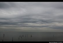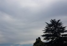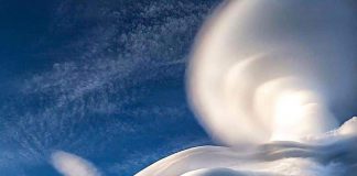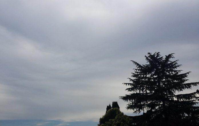
Picture a sky adorned with altostratus clouds, their subtle beauty often overlooked in comparison to more dramatic cloud formations.
Altostratus clouds play an essential role in our atmosphere and can be a harbinger of specific weather conditions. In this post, we’ll investigate the mysterious realm of mid-level clouds, delving into their formation and the conditions that give rise to them.
We will examine the composition and appearance of altostratus clouds, including ice crystals as primary components and visual characteristics such as coloration. Furthermore, we will discuss various types based on formations like undulatus, duplex, floccus, translucidus radiates and opacus varieties.
The accessory cloud type known as mamma will also be explored for its distinguishing features. As we progress through this comprehensive guide on altostratus clouds, you’ll learn about their weather implications – from producing long continuous rains to transforming into nimbostratus clouds.
In addition to understanding how they impact aviation risks due to ice formation on aircraft wings or other potential hazards posed by these unique cloud structures. Finally, we’ll compare them with cirrostratus clouds by discussing differences in altitude between both types while highlighting similarities shared by both cloud forms.
So join us on this journey through the enigmatic realm of altostratus clouds – where science meets artistry in our skies above!
Formation of Altostratus Clouds: A Journey into the Skies
Let’s take a trip up to the clouds.
Have you ever wondered how those gray, featureless altostratus clouds form in our skies? Well, wonder no more.
Advancing Frontal Systems as Catalysts for Formation
The story begins with advancing frontal systems – large masses of air that rise and condense due to weather changes.
The process of formation occurs in the atmosphere between 6.5k and 20k feet AGL.
Composition: Ice Crystals and Snowflakes
Let’s now delve into the composition of altostratus clouds.
Altostratus clouds are primarily made up of ice crystals and snowflakes, which give them their distinct gray or bluish hue.
- Rising air masses are key catalysts for altostratus cloud formation.
- Their main components include water droplets suspended in mid-air alongside ice crystals, which create a unique appearance.
- Above all else, remember that these fascinating formations occur at altitudes ranging anywhere between 6,500 and 20,000 feet high.
Now that you know how altostratus clouds come into existence, let’s explore their appearance and characteristics in the next section. Happy cloud-watching.
Altostratus Clouds: Appearance and Characteristics
Let’s dive into the fascinating world of altostratus clouds.
These mid-level clouds are known for their featureless gray sheets that often cover vast areas of the sky, giving them a mysterious vibe.
Their semi-transparent nature allows sunlight or moonlight to penetrate through, creating an enchanting atmosphere with dimmed light sources appearing as if seen through ground glass.
Altostratus clouds can sometimes prevent shadows from forming on the ground due to their extensive coverage in the sky – quite a unique phenomenon.
- Undulatus: This variety features wave-like formations within these seemingly uniform cloud layers. It adds a mesmerizing touch to your typical cloudy day.
- Duplex: As its name suggests, this type consists of two or more layers stacked atop each other, creating an intriguing visual effect in our skies.
- Floccus: Picture chaotic shreds scattered across the heavens – that’s what you get with floccus altostratus clouds. They bring texture and depth to otherwise monotonous overcast days.
- Radiates & Translucidus: These varieties offer parallel bands running across wide distances (radiates) or semi-transparency where sunlight still passes through (translucidus). Both add character and interest to any skyscape they grace.
- Opacus: Last but not least is opacus – thicker than translucidus and blocking out sunlight completely. This variety can create a moody and dramatic atmosphere, perfect for those who enjoy the darker side of nature.
Now that you’re familiar with their appearance and characteristics, it’s time to step outside on your next cloudy day and appreciate the beauty of altostratus clouds.
Are you curious to discover more about these captivating clouds? Check out this informative resource from the Met Office.
Varieties Based on Formations: The Art of Altostratus Clouds
Altostratus clouds may seem like plain Janes, but they have their own unique charm. Let’s dive into the different varieties based on formations and discover what makes each one special.
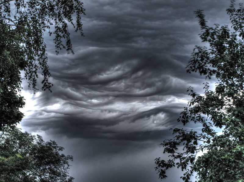
Undulatus: Riding the Waves
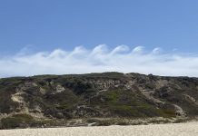
The undulatus variety is marked by wave-like patterns that give these altostratus clouds a mesmerizing appearance in the sky.
Duplex: Double Trouble
Duplex altostratus clouds are distinguished by two or more layers stacked atop each other, creating an interesting visual effect as they float across the sky.
Floccus: Shredded Beauty
The floccus variety consists of chaotically assembled shreds that create a fascinating texture against the backdrop of blue skies or gray horizons. Check out this cloud chart for examples.
Translucidus: A Veil-Like Vision
Semi-transparent and veil-like translucidus altostratus clouds allow sunlight to pass through them, casting a soft glow over everything below. It’s quite magical.
Radiates: Parallel Bands Across The Sky
The radiates variety features parallel bands running across wide distances in the sky – think zebra stripes made up of ice crystals and snowflakes. Learn more about cloud types here.
Opacus: The Sun Blocker
Thicker than its translucidus cousin, opacus altostratus clouds block out sunlight completely, casting a shadow over the land below. Don’t forget your umbrella.
So there you have it – altostratus clouds are far from boring. Each variety has its own unique characteristics that make them an essential part of our ever-changing skies. Want to discover more about these remarkable formations? Check out this comprehensive guide on cloud classification.
Accessory Cloud Types: Mamma & Floccus
We’ll explore two intriguing formations: Mamma and Floccus. Are you ready to embark on this cloudy adventure?
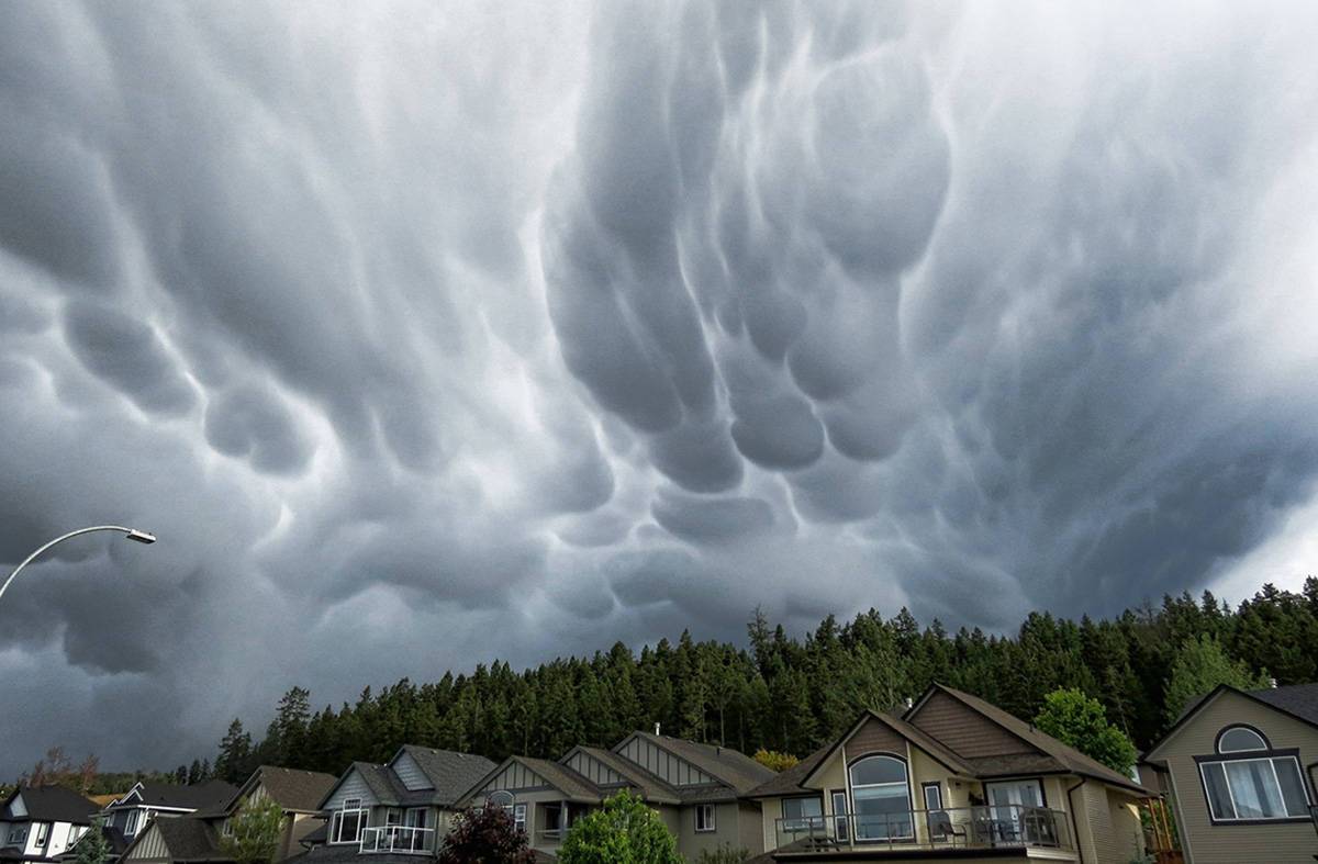
Mamma: Pouch-like Formations on the Underside
First up, we have Mamma Clouds – quite an interesting name, right? These clouds, also known as mammatocumulus or Mammatus, are characterized by pouch-like formations that resemble mammary glands hanging from the underside of a cloud base. This unique formation occurs when cold air sinks down within a warmer environment, creating these captivating structures in the sky.
Floccus: Chaotic Shreds Classified as an Accessory Cloud
Moving on to our second accessory type – Floccus. These clouds sometimes referred to as “shredded cotton balls,” consist of lots of chaotically assembled shreds scattered across vast areas in the sky. Their fluffy appearance is due to their composition primarily consisting of ice crystals and water droplets at varying stages of development.
Weather Impact and Long Continuous Rains: Altostratus Clouds in Action
Hey there, cloud enthusiasts.
Let’s dive into the fascinating world of altostratus clouds and their impact on our weather.
We’ll explore how these mid-level clouds can bring about long continuous rains, sometimes even transforming into nimbostratus clouds.
Production of Long Continuous Rains
Do you know those days when it seems like the rain just won’t stop?
Well, you can thank altostratus clouds for that.
Their unique composition of ice crystals and water droplets allows them to produce long periods of steady rainfall.
Transformation into Nimbostratus Clouds
Sometimes, altostratus clouds decide they want a change in scenery (and name).
In certain conditions, as they move closer to Earth’s surface, they become denser and transform into nimbostratus clouds.
What Does This Mean for Us?
- Rainy Days: When altostratus or nimbostratus are present in the sky, expect prolonged periods of rainfall. Keep your umbrella handy.
- Cool Temperatures: These gray sheets block sunlight from reaching us down below. So don’t be surprised if it’s a bit cooler than usual.
- Increased Humidity: With all that moisture in the air, humidity levels tend to rise. Embrace the frizz.
Fascinated by clouds and weather?
Learn more about different cloud types and their effects on our environment here.
So next time you’re caught in an endless downpour, remember: it’s just altostratus clouds doing their thing.
Aviation Hazards: Icing Effects on Aircraft Wings
Alright, let’s talk about a chilling issue.
Altostratus clouds may seem harmless from the ground, but they can pose serious risks to aviation safety. These clouds are formed by the accumulation of water droplets and/or ice crystals, and they can cause icing on aircraft wings.
Curious? Let me explain:
Comparing Cirrostratus & Altostratus Clouds: A High-Level Overview
Are you curious about the difference between cirrostratus and altostratus clouds? Well, buckle up because we’re about to embark on a cloud-tastic journey.
Although cirrostratus and altostratus clouds may appear similar, they have some key differences that set them apart.
FAQs in Relation to Altostratus Clouds
What are some interesting facts about altostratus clouds?
Altostratus clouds form at mid-level altitudes between 6,500 and 20,000 feet. They often result from the lifting of large air masses due to frontal systems. Altostratus clouds can produce long continuous rains and may transform into nimbostratus clouds. Their primary components are water droplets and ice crystals, giving them a grayish or bluish appearance.
What is the best description of altostratus clouds?
Altostratus clouds are mid-level, gray, or blue-gray sheet-like cloud formations that usually cover the entire sky. They have a semi-transparent to opaque appearance depending on their thickness and composition. These clouds typically indicate an approaching warm front with potential precipitation in the form of rain or snow.
What are the effects of altostratus clouds?
Effects of altostratus clouds include producing long continuous rains, transforming into nimbostratus for heavier precipitation events, and posing aviation risks such as ice formation on aircraft wings. Additionally, they serve as indicators for upcoming weather changes like warmer temperatures or increased humidity levels.
What are 3 facts about altocumulus clouds?
- Altocumulus clouds form at similar altitudes as altostratus but have smaller individual elements resembling cotton balls.
- Their presence indicates instability in the middle atmospheric layers which could lead to thunderstorms later in the day.
- A subtype called “altocumulus castellanus” has turrets extending upwards, indicating stronger convective activity within these cloud formations.
Conclusion
Altostratus clouds are mid-level clouds that form in a variety of atmospheric conditions and can have significant implications for weather and aviation. They are primarily composed of ice crystals, giving them a unique appearance with different varieties based on their formations.
Their presence often indicates the potential for long continuous rains or transformation into nimbostratus clouds. Aviation risks include ice formation on aircraft wings and other hazards. While similar to cirrostratus clouds in some ways, altostratus clouds differ in altitude and have their own distinguishing features.


