Shaking Things Up: Exploring the Dynamic Relationship Between Tectonic Plates and Earthquake Formation
Earthquakes are created by a complex process taking place within the Earth’s crust, and understanding this mechanism can provide us with valuable knowledge about our planet. As nature lovers, understanding the mechanisms behind these powerful events can provide us with valuable insights into our planet’s geological behavior.
By examining the dynamics of tectonic plate interactions, this blog post will explore how their movements lead to pressure buildup and cause earthquakes. We’ll also discuss various methods used for measuring earthquakes, including different types of magnitude scales and seismic wave analysis techniques.
Additionally, we will identify major regions prone to earthquakes on global maps and examine factors contributing to regional vulnerability. Finally, we’ll take a closer look at one of history’s most devastating earthquakes – the 1960 Valdivia Earthquake – shedding light on its impact on local communities as well as tsunami effects across Pacific nations.
Earthquake Formation
Have you ever wondered what lies beneath our feet? The Earth is composed of several layers, each with its unique properties and characteristics. Seismic waves from large earthquakes provide us with valuable information about the internal structure of the Earth.
The Crust
The outermost layer of the Earth is called the crust. It varies in thickness from 25 to 70 km under continents and from 5 to 10 km under oceans. The continental crust is quite complex in structure and made up of different kinds of rocks, such as granite, basalt, and sandstone.
The Mantle
Beneath the crust lies a dense layer known as the mantle extending to a depth of approximately 2890 km. It consists mainly of solid silicate rocks that can flow like plastic over geological timescales due to convection currents caused by heat escaping from deep within the Earth’s core.
We know that both P- and S-waves travel through this layer during an earthquake, demonstrating that it is solid throughout most parts; however, there are some areas where it behaves more like a fluid over very long periods because rocks move slowly around giant convection cells within it.
The Core
At approximately 2900km below ground level begins another distinct region – the core – which makes up almost half (about one-third) of the total volume on average! We know this exists because seismic waves refract or bend when they pass through it, creating shadow zones between distances ranging from 103º and 143º around the globe, indicating the presence of iron-rich material.
The core has two parts:
- Outer Core: This part surrounds the inner core consisting mostly of liquid molten iron-nickel alloy spinning faster than the Earth itself, which generates a magnetic field that protects us from solar winds.
- Inner Core: This part is solid and composed of the iron-nickel alloy under such high pressure and temperature it cannot melt.
The Earth’s core plays an essential role in the planet’s magnetic field, which helps protect life on our planet by deflecting harmful cosmic rays away from Earth. It also generates heat through radioactive decay, contributing to volcanic activity.
In conclusion, understanding the structure of the Earth is crucial for scientists as they study natural phenomena like earthquakes and volcanoes or predict how climate change will affect our planet over time. By learning about these different layers, we can better understand how our world works and what makes it so unique!
Earthquakes occur due to the movement of tectonic plates, which are large pieces of the Earth’s crust that move slowly over time. The San Andreas Fault in California is an example of a boundary between two tectonic plates. Plate tectonics is the theory that explains how these plates move and interact with each other.
Tectonic Plates and Earthquake Formation
Earthquakes are an amazing and powerful occurrence in nature that can be both astonishing and destructive. The movement of tectonic plates beneath the Earth’s surface is what drives earthquake formation. These massive slabs constantly shift, but their edges sometimes catch and stick together, causing immense pressure to build up. When this energy is released, it breaks the Earth’s crust and results in intense vibrations known as earthquakes.
Understanding Tectonic Plate Movements
The outer layer of our planet is made up of several large tectonic plates that float on top of the partially molten mantle below. These plates move at varying speeds due to processes like convection currents within the mantle or gravitational forces from other geological features, such as subduction zones where one plate sinks beneath another.
- Divergent boundaries: Where two tectonic plates move away from each other, creating new crust through volcanic activity (e.g., Mid-Atlantic Ridge).
- Convergent boundaries: Where two tectonic plates collide with each other, leading to mountain building or subduction (e.g., the Himalayas).
- Transform boundaries: Where two tectonic plates slide past each other horizontally without creating or destroying any crust (e.g., San Andreas Fault).
Causes of Pressure Buildup Between Plates
The friction between adjoining tectonic plate edges causes them to become stuck together even though they continue moving slowly relative to one another.
This leads to a buildup of stress along the fault line, which can eventually become too much for the rock formations to withstand. When this happens, the plates suddenly slip past each other, releasing all that pent-up energy in an instant and causing an earthquake.
There are several factors that contribute to pressure buildup between tectonic plates:
- Plate movement speed: Faster-moving plates tend to generate more friction and, thus, greater potential for earthquakes.
- Type of rocks at plate boundaries: Some rock types have higher resistance against sliding or breaking than others, leading to increased stress accumulation before failure occurs.
- Fault geometry: The shape and orientation of faults can influence how easily they accumulate stress and their likelihood of producing large earthquakes when they fail.
To better understand these complex processes behind earthquake formation and predict future seismic events more accurately, scientists continue studying various aspects such as tectonic plate movements, geological structures at fault zones, or even monitoring changes in Earth’s magnetic field related to crustal deformation patterns over time.
By doing so, we hope not only to gain insight into our planet’s inner workings but also to develop strategies aimed at mitigating risks associated with living near active fault lines around the world today.
Tectonic plates play a crucial role in the assessment of earthquakes, from their formation to measuring them using seismic waves. To further explore this topic, analyzing seismic waves for accurate measurements on different types of magnitude scales is essential.
Key Takeaway:
Tectonic plates constantly shift, but their edges sometimes catch and stick together, causing immense pressure to build up. When this energy is released, it breaks the Earth’s crust and results in intense vibrations known as earthquakes. Scientists study various aspects, such as tectonic plate movements, to better understand the complex processes behind earthquake formation and predict future seismic events more accurately.
Measuring Earthquakes
The intensity of an earthquake is quantified using a measurement called magnitude. This scale helps determine how much energy was released during an event by analyzing seismic waves produced by ground shaking. Magnitude scales range from minor tremors to catastrophic events that cause widespread devastation.
This section will explore the different types of magnitude scales and discuss how scientists analyze seismic waves for accurate measurements.
Different Types of Magnitude Scales
There are several magnitude scales used to measure earthquakes, each with its own unique characteristics and applications. Some common ones include:
- Richter Scale: Developed in 1935 by Charles F. Richter, this scale measures the amplitude of seismic waves on a logarithmic scale ranging from 0 to 10.
- Moment Magnitude Scale (Mw): A more modern and widely-used method that takes into account the size of the fault rupture, amount of slip along the fault, and rigidity of rocks involved in producing seismic waves.
- Modified Mercalli Intensity (MMI) Scale: Instead of measuring energy release directly as other scales do, MMI focuses on assessing the damage caused by earthquakes based on human observations and structural impacts.
Analyzing Seismic Waves for Accurate Measurements
Seismic waves are the vibrations produced by earthquakes that travel through the Earth’s crust. There are two main types of seismic waves:
- Body Waves: These waves move through the Earth’s interior and consist of Primary (P) and Secondary (S) waves.
- Surface Waves: Traveling along the Earth’s surface, these include Love (L) and Rayleigh (R) waves, which cause most of the shaking felt during an earthquake.
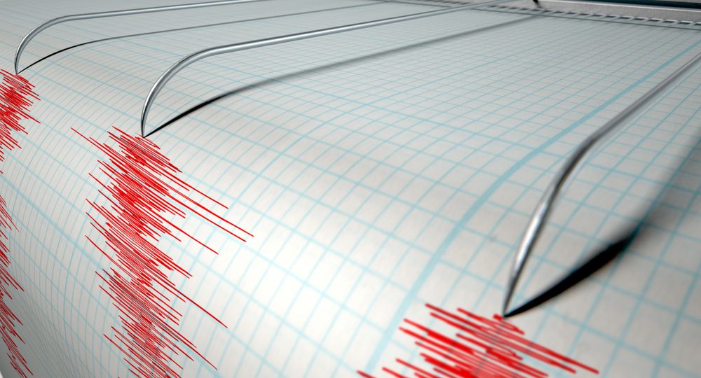
Scientists use seismographs to record seismic wave activity to measure an earthquake’s magnitude accurately. By analyzing data from multiple stations around the world, they can determine how strong an earthquake was and pinpoint its epicenter – or point of origin beneath the Earth’s surface.
This information is crucial for understanding potential risks associated with future earthquakes in a given region.
Utilizing networks such as USGS’ Global Seismographic Network (GSN), researchers observe long-term trends in seismic activity, aiding them in foreseeing regions with a heightened risk of dangerous earthquakes related to tectonic plate movements. This helps them identify trends related to tectonic plate movements and better predict areas prone to increased risk for damaging earthquakes.
Measuring earthquakes requires a thorough understanding of seismic waves and the various magnitude scales used to accurately measure them. Having acquired the necessary knowledge, we can now proceed to pinpoint seismic-prone areas on a global scale.
Key Takeaway:
Scientists use different magnitude scales to measure earthquakes, including the Richter Scale and Moment Magnitude Scale. Seismic waves are analyzed using seismographs to accurately determine an earthquake’s strength and epicenter while monitoring global seismic activity helps identify areas prone to increased risk for damaging earthquakes.
Major Regions Prone to Earthquakes
Natural disasters such as earthquakes can occur anywhere, but certain regions are more prone to seismic activity due to their proximity to active fault lines. Despite their global presence, certain areas are more susceptible to seismic activity due to the frequent collision of tectonic plates along active fault lines. In this section, we will explore the three primary earthquake-prone areas around the world – the Mid-Atlantic Ridge, Alpide Belt, and Circumpacific Belt.
Identifying High-Risk Zones on Global Maps
To better understand the distribution of earthquakes worldwide, scientists have identified specific high-risk zones by analyzing patterns in seismic activity. These zones typically lie along tectonic plate boundaries, where immense pressure builds up as plates move against one another. The following list highlights these major regions:
- Mid-Atlantic Ridge: This underwater mountain range stretches from Iceland down through the Atlantic Ocean floor towards Antarctica, marking the boundary between North American and Eurasian Plates.
- Alpide Belt: Spanning across Europe and Asia from Gibraltar to Indonesia, this zone includes several smaller fault systems like those responsible for earthquakes in Italy or Turkey.
- Circumpacific Belt (Ring of Fire): Encircling the Pacific Ocean basin, this area is home to about 90% of all recorded earthquakes globally due to its numerous subduction zones, such as the San Andreas Fault in California or Japan Trench off the eastern coast of Honshu Island.
Factors Contributing to Regional Vulnerability
While tectonic plate interactions play a significant role in determining earthquake-prone regions, other factors also contribute to the vulnerability of these areas. Some key elements include:
- Population Density: Highly populated areas are more susceptible to damage and casualties during an earthquake event. For example, densely-populated cities like Tokyo or Los Angeles are located near active fault lines, increasing their risk.
- Infrastructure Quality: Poorly constructed buildings and infrastructure can exacerbate the impact of earthquakes on communities. Developing countries with limited resources often struggle to implement effective building codes and safety measures.
- Natural Resources Extraction: Activities such as mining or drilling for oil can trigger small-scale seismic events known as induced earthquakes. While typically not as powerful as natural ones, they still pose risks for nearby residents and infrastructure.
In conclusion, to mitigate the devastating effects of earthquakes in high-risk zones, it is crucial that governments invest in preparedness efforts such as improving building standards, implementing early warning systems, and educating citizens about proper response strategies during an emergency situation. By understanding regional vulnerabilities and working proactively towards reducing them, we can help create safer environments for all those living within these seismically-active regions around our planet.
It is important to understand the areas of highest risk for earthquakes, as this knowledge can help in mitigating potential damage and loss. To further illustrate the power of seismic activity, we will now discuss one particular event: The 1960 Valdivia Earthquake.
Key Takeaway:
This section discusses the three primary earthquake-prone areas around the world – the Mid-Atlantic Ridge, Alpide Belt, and Circumpacific Belt. Scientists have identified specific high-risk zones by analyzing patterns in seismic activity along tectonic plate boundaries. Factors contributing to regional vulnerability include population density, infrastructure quality, and natural resource extraction.
The 1960 Valdivia Earthquake
The largest recorded earthquake in history took place near Valdivia, Chile, on May 22, 1960. This incredible seismic event, registering a magnitude of nearly 9.5, left an unforgettable impression and created some stunning geological formations.
Impact on Local Communities & Infrastructure
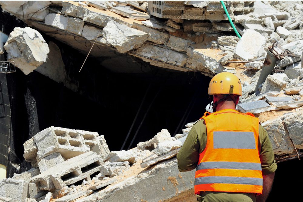
This catastrophic earthquake caused widespread destruction across southern Chile. Entire cities were leveled, with buildings collapsing under the immense force of the tremors. The death toll was estimated to be between 1,000 and 6,000 people, while tens of thousands more were left homeless due to extensive damage to infrastructure.
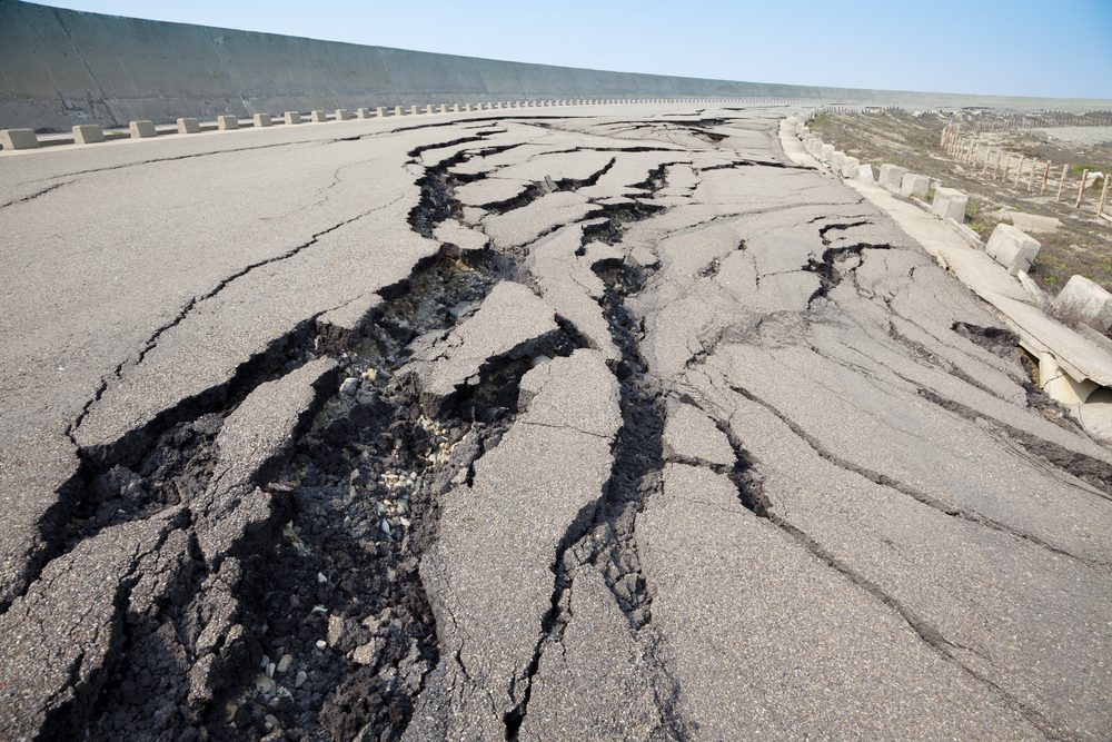
In addition to causing landslides and flooding from ruptured dams, the quake also led to significant changes in local geography. For instance, large sections of the coastline were raised several meters above sea level, creating new landforms that can still be seen today.
Tsunami Effects Across Pacific Nations
The powerful seismic activity generated by the Valdivia Earthquake didn’t just impact Chile; it also set off a deadly tsunami that reached heights up to 80 feet (24 meters). This massive wave traveled at speeds exceeding 200 miles per hour (322 kilometers per hour), wreaking havoc along coastlines throughout the Pacific Ocean basin.
- Hawaii: Waves as high as 35 feet (10 meters) struck Hilo, causing extensive damage and claiming 61 lives.
- Japan: The tsunami reached Japan’s shores, killing at least 142 people and destroying more than 1,600 homes.
- The Philippines: In the northern region of Luzon Island, waves up to 9 feet (2.7 meters) high caused significant destruction in coastal communities.
This far-reaching disaster serves as a stark reminder of the immense power that lies beneath our planet’s surface. As we continue to study earthquakes and their effects on our world, we must develop strategies for mitigating the risks associated with these natural phenomena – both locally and globally.
Earthquakes occur due to the movement of tectonic plates, which are massive slabs of rock that make up the Earth’s crust. When these plates shift, seismic waves are generated, causing the ground to shake. The San Andreas Fault in California is a prime example of this phenomenon, as it marks the boundary between two major tectonic plates.
Plate tectonics, which is the study of these plates and their movements, is a crucial field of study for understanding earthquakes and other geological events. At the core of the Earth lies a molten ball of iron and nickel, which generates the magnetic field that surrounds our planet. This core is also responsible for driving the movement of tectonic plates, making it a key player in the formation of earthquakes.
Key Takeaway:
The 1960 Valdivia earthquake in Chile, registering a magnitude of 9.5 and leaving thousands dead or homeless, was the most powerful seismic event ever recorded. The quake also generated a deadly tsunami that reached heights up to 80 feet, wreaking havoc along coastlines throughout the Pacific Ocean basin. This disaster highlights the immense power beneath our planet’s surface and emphasizes the need for strategies to mitigate risks associated with earthquakes globally.
FAQs in Relation to Earthquake Formation
What is the formation of an earthquake?
Earthquakes occur when stress builds up within Earth’s crust due to the movements of tectonic plates. This stress causes rocks to break and slip along fault lines, releasing energy in the form of seismic waves. The point where this rupture begins is called the focus, while the location directly above it on Earth’s surface is known as the epicenter.
What are the three main causes of earthquakes?
- Tectonic Plate Movements: Shifting and colliding plates create stress that leads to earthquakes.
- Volcanic Activity: Magma movement can cause pressure buildup and trigger earthquakes near volcanoes.
- Human Activities: Mining, reservoir impoundment, or underground nuclear tests can induce seismic events.
What Plate Boundary Causes Earthquakes?
If you’re a nature lover, then understanding the science behind natural phenomena is crucial. One of these phenomena that has always fascinated people is earthquakes. Earthquakes occur when there’s sudden movement along faults in the earth’s crust, resulting in seismic waves that can cause significant damage to property and loss of life.
The Science Behind Earthquake Formation
Earthquake formation has everything to do with tectonic plates – massive slabs of rock that make up the earth’s surface. These plates are constantly moving due to convection currents within the earth’s mantle layer, which causes them to collide or move away from each other at plate boundaries.
The San Andreas Fault in California is one such boundary where two major tectonic plates meet: The Pacific Plate and North American Plate. As they grind against each other, friction builds up until it releases suddenly as an earthquake.
Plate Tectonics and Seismic Waves
Seismic waves are vibrations caused by energy released during an earthquake. They travel through different layers of the earth at varying speeds depending on their type, primary (P) waves being faster than secondary (S) waves.
In addition to causing destruction on land, earthquakes also provide valuable information about what lies beneath our feet – including details about plate tectonics and even how heat flows through Earth’s core!
- To sum it up:
- Tectonic Plates cause earthquakes,
- The San Andreas fault line is a prime example,
- P-waves travel faster than S-waves,
- We can learn much about the earth’s core from studying earthquakes.
Understanding how and why earthquakes occur is crucial for both our safety and scientific advancement. By continuing to study this natural phenomenon, we can better prepare ourselves for future events while also learning more about the planet we call home.
Sources: USGS
What causes an earthquake?
Earthquakes are primarily caused by tectonic plate movements creating stress within Earth’s crust. When this stress exceeds rock strength, they fracture along fault lines, releasing stored energy as seismic waves. Other factors like volcanic activity or human-induced actions such as mining may also contribute to triggering these events, leading to ground shaking and potential damage in affected regions.
Conclusion
Understanding earthquake formation is crucial for nature lovers who want to explore the world around them. By learning about the movement of tectonic plates and the pressure buildup between them, we can better understand how earthquakes occur.
Accurately measuring earthquakes is also important in predicting future seismic activity. Different magnitude scales and the analysis of seismic waves help us determine the severity of an earthquake.
If you’re planning on traveling to regions prone to earthquakes, it’s essential to identify high-risk zones on global maps and be aware of the factors that contribute to regional vulnerability. The San Andreas Fault, for example, is a well-known area of high seismic activity due to the movement of tectonic plates.
The study of plate tectonics has helped us understand the Earth’s core and how it affects the movement of tectonic plates. This knowledge has allowed us to better predict and prepare for earthquakes.
The 1960 Valdivia earthquake serves as a reminder of the devastating impact that earthquakes can have on local communities and infrastructure, as well as the tsunami effects across Pacific nations.


