What is a low-pressure system?
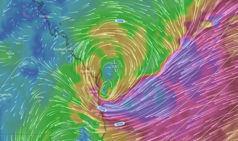
In meteorology, the term low-pressure system refers to a low-pressure region in the upper or lower atmosphere and is a place where the pressure of the atmosphere is less than the adjacent places.
Low-pressure zones are usually associated with weather that is not ideal (such as windy, cloudy and possibly rainy storms) whereas high-pressure zones are associated with milder breezes with clear, clear skies.
Winds circle anti-clockwise around lows in the northern hemisphere, and clockwise in the southern hemisphere, due to opposing Coriolis forces. Low-pressure systems develop under zones of wind divergence which occur in the upper layers within the atmospheric layer (aloft).
The process of creating the low-pressure zone is known as cyclogenesis. Meteorology refers to atmospheric divergence as in the air is observed in two types of areas:
The first is in the area on the east side of upper troughs, which form half of a Rossby wave within the Westerlies (a trough with a large wavelength that extends through the troposphere). A second is an area where wind divergence aloft occurs ahead of embedded shortwave troughs, which are of smaller wavelengths.
Diverging winds aloft, ahead of these troughs, cause atmospheric lift within the troposphere below as air flows upwards away from the surface, which lowers surface pressures as this upward motion partially counteracts the force of gravity packing the air close to the ground. (Source: Wikipedia)
What is an East Coast Low?
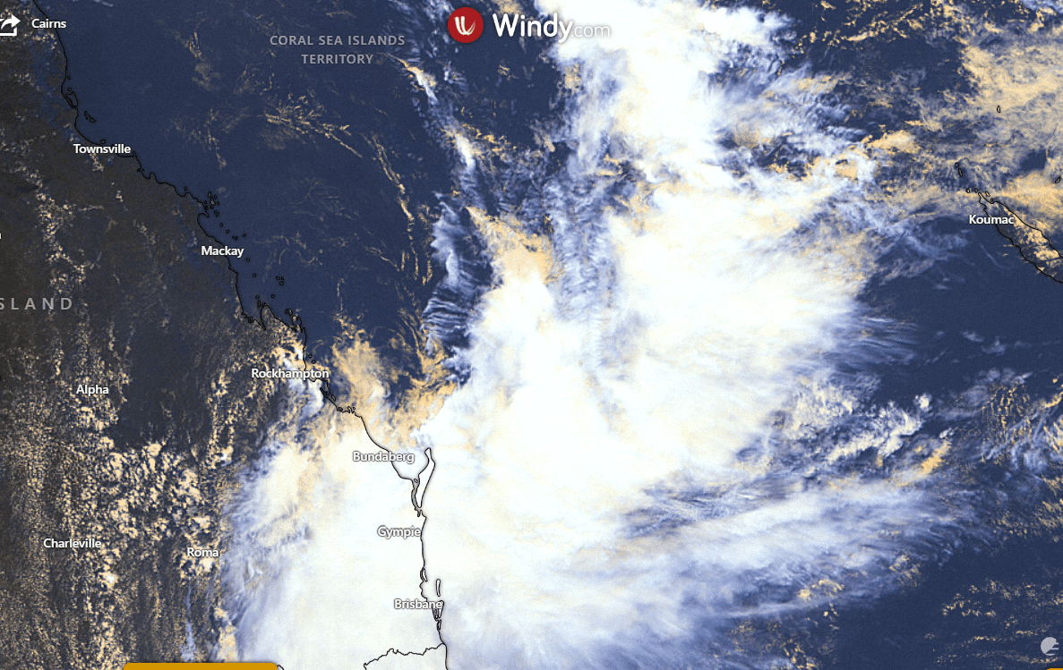
East Coast Lows (ECL) are powerful low-pressure systems that happen typically frequently throughout the year off the coast of eastern Australia, particularly in the southern part of Queensland, NSW and eastern Victoria. While they can happen anytime throughout the year they tend to be more frequent during the months of winter and autumn, with their peak frequency during June.
East Coast Lows will often increase in intensity over a time of between 12 and 24 hours, making them among the most hazardous weather patterns that impact the east coast. East coast lows can also be seen off the coasts of Africa or America and are often referred to as east coast storms.
What causes an east coast low?
East Coast Lows can develop in a variety of conditions. In summer, they could be ex-tropical storms. In other seasons typically, they grow rapidly offshore within a trough that is already in place of low pressure because of favourable weather conditions within the atmosphere in conjunction with warmer ocean surface temperatures.
ECLs could also occur in the aftermath of cold fronts heading across Victoria to the Tasman Sea. The gradients in sea surface temperatures caused by the warm eddies in the East Australian Current are an important factor in the formation of lows.
Another explanation
The East Coast Low forms when an extremely strong upper disturbance occurs near the coastline’s eastern end. It is similar to waves in the upper air levels (around 10 to 15 km higher than the ground). As it approaches the coast, it triggers the growth of another wave (in this instance the low-pressure system or trough) in the lower levels of the atmosphere on its eastern side.
When the surface low moves across the ocean it will cause temperature differences (or the gradient) between warmer water and the cooler land (or warmer water that has cooler water mass) can trigger rapid growth in the low-pressure system.
The heavy rains and gales usually occur south of the low’s centre, whereas further north from the lowest, there are clear skies. Forecasters face a challenge in predicting accurately the location, direction and intensity of the central part of the low.
A further key element for the formation of an East Coast Low is a “cradling high”. This is a high-pressure system located in the Southern Tasman Sea, which blocks the East Coast Low from moving away from the coast and makes it a longer-lasting and significant system.
The high also causes an increased pressure gradient on the southern part of the low leading to more powerful winds.
How do we define the term “low” as it relates to one that is an East Coast Low?
The most basic definition of a low-pressure system is that
- It is a closed system (has the lowest pressure in the central region which is surrounded by a greater pressure);
- The formations occur between 20degS and 40degS (latitude) on the eastern Australian coast.
- Stays within about 200 km of the coast for a minimum of 12 hours.
- Has a pressure gradient of 4 hPa/100 km (implying that the pressure drops by at least 4 hectopascals as we move 100 km towards the centre of the low) and/or is an intense cyclonic system (one that is generating very fast winds turning in a clockwise direction);
- Is often associated with the occurrence of severe weather (such as destructive wind, heavy rain, and hazardous seas).
Characteristics of an east coast low
East Coast Lows may cause gale to storm-force wind, extremely heavy rainfall and, in some instances, coastal flooding.
Although the maximum speeds recorded are less than those recorded in tropical cyclones with severe impacts A gust that was 165 km/h was observed at Newcastle as part of an East Coast Low that sunk the bulk transporter Sygna in 1974.
People also ask
What is the difference between an east coast low and a cyclone?
Tropical cyclones are formed over warm tropical waters, where the temperature of the sea’s surface is higher than 26degC.
They are known to have long cycles, usually around an entire week. Extreme tropical cyclones could cause substantial damage to property with winds exceeding 180 km/h in the centre, massive rainfall, and coastal flooding through storm surges.
East Coast Lows may cause strong to storm-force winds as well as very heavy rainfall, and, in some instances, coastal flooding. Although maximum wind speeds recorded are less than that of severe tropical cyclones, however, a speed that was 165 kilometres per hour was observed at Newcastle in connection with the East Coast Low that sunk the bulk carrier Sygna in 1974.
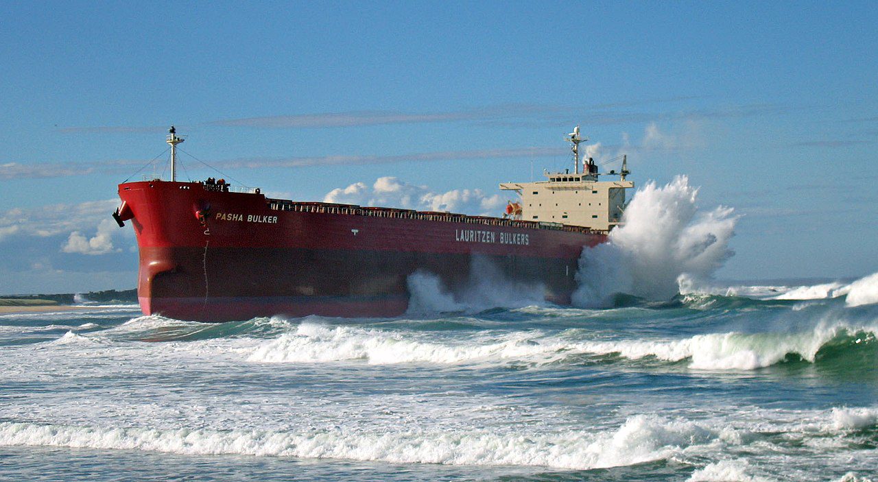
In the initial phase of ECLs of June 2007, in which the bulk ship Pasha Bulker ran aground, speeds of 105 km/h in the morning at 6:21 AM on June 8 and 1:32 am on June 9 were observed in Newcastle.
At what time of year are East Coast Lows most common?
Southern Queensland, New South Wales and Eastern Victoria are impacted by extratropical storms, also known by the name of East Coast Lows (ECLs). They can happen at any time, however, they are more common during the winter and autumn seasons.
In what direction does an East Coast Low go?
A normal east coast low would travel along the coast from north to south, but erratic movements had been observed in the past.
Why are East Coast Lows such an issue for our coastal environment?
East coast lows (ECLs) are powerful low-pressure storms that are common on the East Coast of Australia. They can occur anytime during the year and are significant ECLs occur approximately 10 times per year. These storms can bring damaging and gale-force winds, large surf and heavy rainfall. They can cause coastal erosion and flooding as well as inundation.
What does the term rain bomb mean?
Noun. rain bomb (plural rain bombs) A wet microburst or macroburst; a downdraft produced by a thunderstorm. (source: Collins)


