Queensland Long Range Weather Forecast
La Nina Watch announced by US Climate Prediction Centre
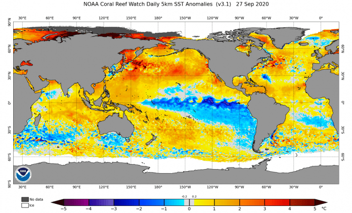
There are increasing indications that La Niña could redevelop in the Pacific Ocean later this year, urging the US Climate Prediction Centre to declare a La Niña Watch this week.
The Pacific Ocean has been neutral following the last La Niña came to an end back in March of this year. This signifies that ocean and atmospheric conditions over the equatorial Pacific are typical for this time of year, with neither La Niña nor El Niño in position.
But forecast models hint that La Niña could redevelop through the second half of 2021, possibly opening the door to the first back-to-back La Nina phenomenon in a decade.
According to the US Climate Prediction Centre (CPC), neutral circumstances are likely to continue in the Pacific Ocean into the rest of the Southern Hemisphere winter and into spring.
Nevertheless, the organisation gives a 66 per cent chance of La Niña transpiring in the three months from November 2021 to January 2022.
While Australia’s Bureau of Meteorology is yet to follow the CPC in announcing a La Niña Watch, they do recognise the potential for La Niña later in the year.
The latest climate driver update from the Bureau states that neutral conditions are expected to continue in the Pacific Ocean through the rest of the Southern Hemisphere’s winter. At the same time, “two models forecast temperatures approaching the La Niña threshold during September.”
La Niña usually produces above average rain over large regions of Australia throughout winter, spring and early summer.
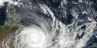
It can also induce an early start to Australia’s northern wet season and normally enhance the number of tropical cyclones in the Australian region in November and April.
Some La Ninas have produced extremely strong weather systems, including Cyclone Tracy and the 2011 floods.
Read more about the La Nina Climate Driver and what it means for Australia.
The Bureau of Meteorology recommends the following actions during violent thunderstorms or severe weather events,
* Move your car under cover or away from trees.
* Secure loose outdoor items.
* Never drive, walk or ride through floodwaters. If it’s flooded, forget it.
* Seek shelter, preferably indoors and never under trees.
* Avoid using the telephone during a thunderstorm.
* Beware of fallen trees and powerlines.
* For emergency assistance contact the SES on 132 500.

- Please keep an eye on the Bureau of Meteorology Brisbane Weather radar for live storm updates.
- Also, keep an eye on the weather warnings page for Queensland.
- Be prepared for severe thunderstorms this season. Read the Bureau of Meteorology’s Preparation and safety during thunderstorms
Weather Maps and Tools
- Queensland Live Weather & Lightning Radar Map
- Queensland Live Wind & Gusts Radar Map
- Queensland Live Temperature Map
- Queensland Waves & Swells Map
For further information and live updates about Queensland weather forecasts visit:
- https://www.facebook.com/HigginsStormChasing/
- https://www.facebook.com/ozcyclonechasers
- https://www.facebook.com/SevereWeatherAustralia/
- https://www.facebook.com/seqweather
- https://www.facebook.com/BrisbaneCityWeather
- https://www.facebook.com/Tims-Severe-Weather-Queensland-100157335236883/
Weather forecasts for Queensland: Gold Coast, Brisbane, Sunshine Coast, Gympie, Bundaberg, Maryborough, Rockhampton, Gladstone, Mackay, Cairns all other regional centres. Our forecasts include long term and short term forecasts as well as significant and severe weather events affecting the regions.


