What are Mammatus clouds?
Mammatus clouds are often formed under cumulonimbus cloud anvils caused by severe thunderstorms, hail, or unsettled weather. Anvils are the tops of thunderstorm clouds that have turned to ice because of the high level in the atmosphere, and they spread out in front of the cumulonimbus cloud in the direction the storm is traveling.
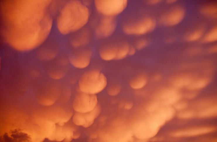
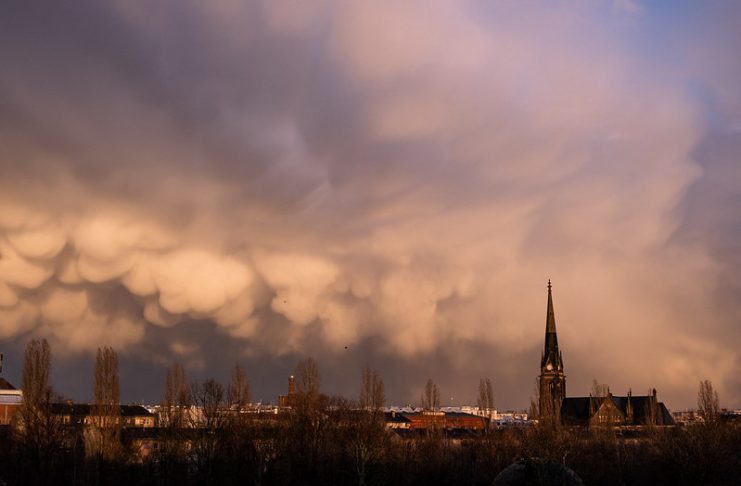
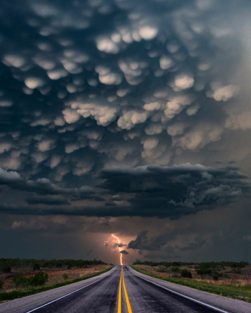
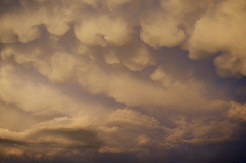
Mammatus are typically found forming off the underside of the cumulonimbus thundercloud. These clouds cause thunderstorms, rain, and lightning. They have a hanging appearance and can be spectacular, especially if a sunset or sunlight highlights them.
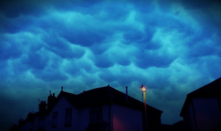
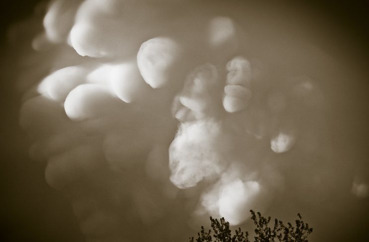
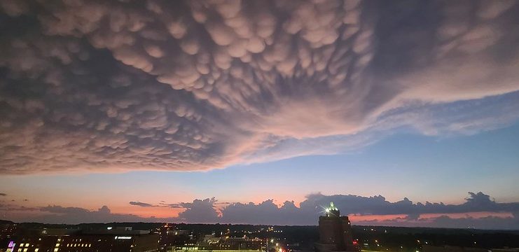
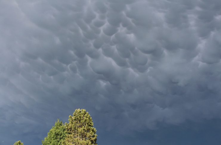
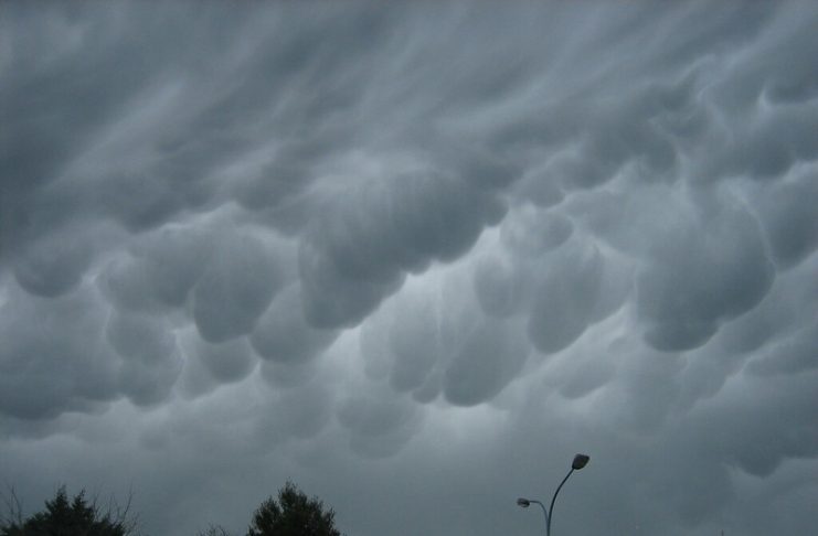
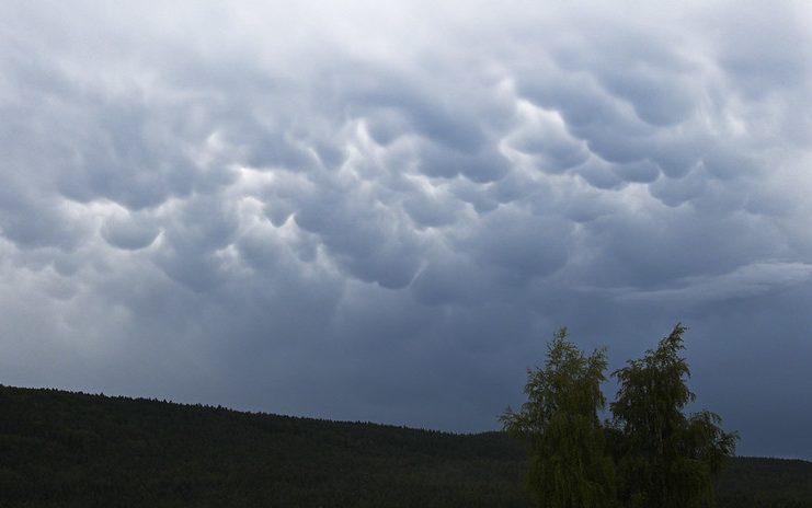
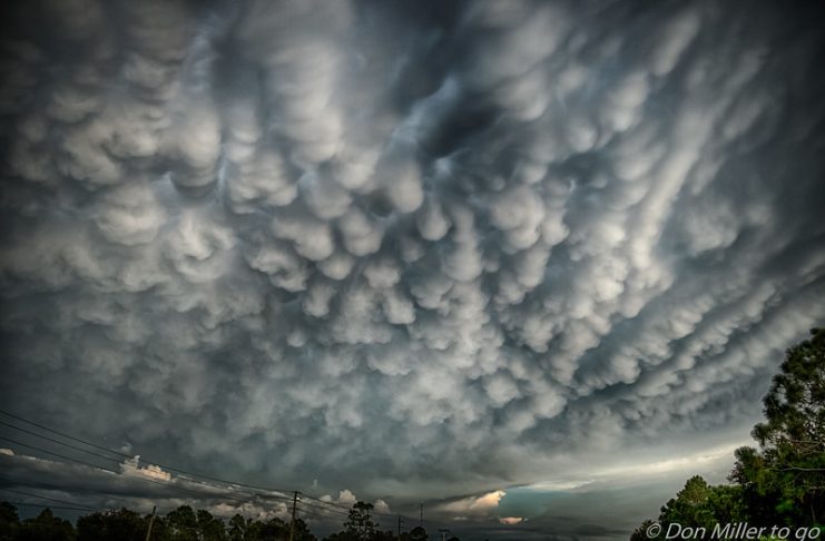
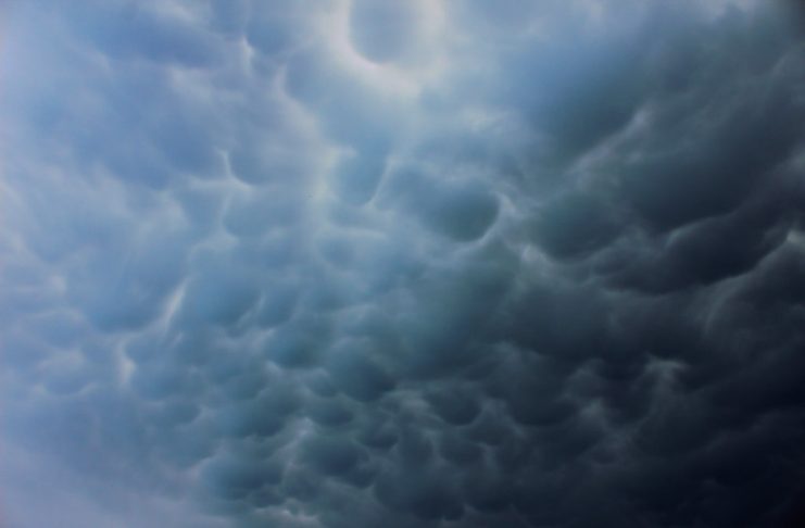
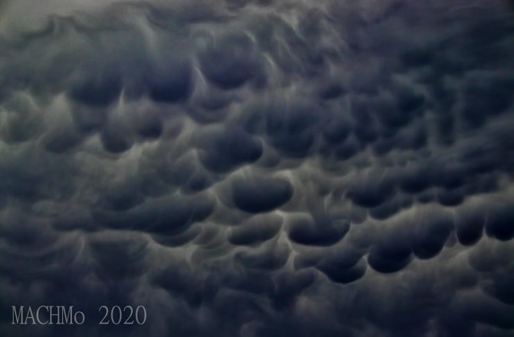
Mammatus (mamma or mammato cumulus), meaning “mammary cloud,” is a cellular pattern of pouches hanging underneath the bottom of a cloud, typically cumulonimbus rainclouds. However, they’ll be attached to other classes of parent clouds. The name Mammatus springs from the Latin mamma (meaning “udder” or “breast”).
Consistent with the WMO International Cloud Atlas, mamma may be an additional cloud feature instead of a genus, species, or cloud. They’re formed by cold air sinking to form the pockets, contrary to the puffs of clouds rising through warm air convection. These cloud formations were first described in 1894 by William Clement Ley.

What Causes Mammatus Clouds?
The exact causes of these clouds are still this day not entirely sure. Several meteorologists have documented several theories about the development and reasons for these clouds, which can be found on this Wikipedia page.
Mammatus Clouds are an enduring weather phenomenon produced by mother nature and still elude the exact cause of these strange cloud formations to this day. The weather and its characteristics are as mysterious to me as a weather enthusiast as it was when I was a child.
I used to watch storms and cyclones coming in from afar from a local weather radar or on the news and admire how beautiful and devastating weather systems and severe thunderstorms can be. These unique cloud formations prove that nature continues to throw unexplained occurrences at us worldwide every day.
How do Mammatus clouds form?
Mammatus clouds are usually formed in unsettled weather and are associated with large cumulonimbus clouds or thunderstorms.
Typically, turbulence within the cumulonimbus will cause Mammatus to form up their shape, especially on the projecting anvil’s underside because it rapidly descends to lower levels. This reverses the standard cloud-forming process of upward growth, making for an uneven cloud base.
Mammatus Cloud Characteristics
Mammatus are most frequently related to anvil clouds and also severe thunderstorms. They often extend from the bottom of a cumulonimbus. Still, They can also be found under altostratus, cirrus clouds, and volcanic ash clouds.
When occurring in cumulonimbus, Mammatus clouds often indicate a powerful storm. Thanks to the intensely sheared environment during which Mammatus form, aviators & pilots are strongly cautioned to avoid cumulonimbus clouds with Mammatus.
They indicate convectively induced turbulence. Contrails can also produce lobes, but these are incorrectly termed Mammatus.
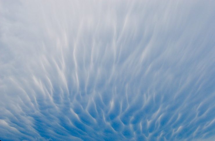
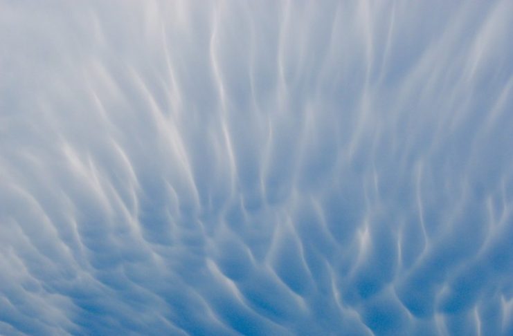
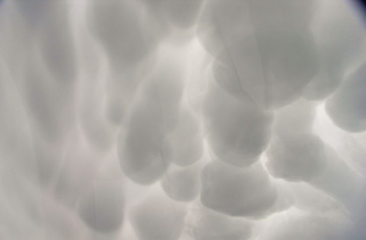
Mammatus appear smooth, ragged, or lumpy lobes and opaque or translucent.
Because Mammatus clouds develop as a grouping of lobes, the way they clump together can vary from an isolated cluster to an area of mammae, which covers many kilometers to being organized along a line and can be composed of unequal or similarly-sized lobes.
The individual Mammatus lobe has average diameters of one to three kilometers (0.6–1.9 mi) and lengths on the average of 1⁄2 kilometers (0.3 mi).
A lobe can last 10 minutes, but an entire cluster of mamma can range from a quarter-hour to a couple of hours. They’re usually composed of ice but can also mix with liquid water or virtually entirely liquid water.
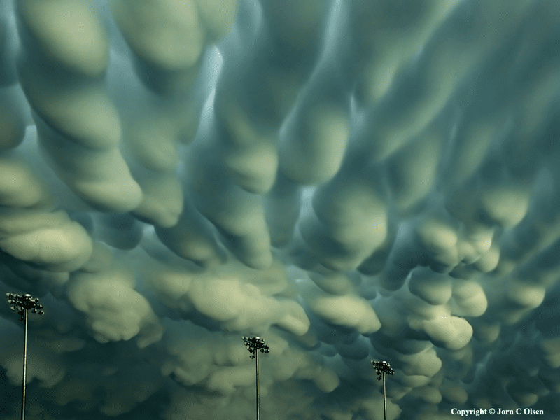
True to their ominous & spectacular appearance, Mammatus clouds are often harbingers of a coming storm, decaying storm, or other extreme weather systems. Typically composed primarily of ice, they will extend for miles or kilometers in each direction. Individual formations can remain visibly static for ten to fifteen minutes.
While they’ll appear foreboding, they’re merely the messengers – appearing around before or maybe after severe weather or thunderstorms.
Mammatus clouds are pouch-like protrusions hanging from clouds’ undersides, usually thunderstorm anvil clouds and other clouds. Composed primarily of ice, these cloud pouches can extend many miles in any direction, remaining visible in your sky for perhaps ten or quarter-hour at a time.
People associate them with severe weather, and it’s true they will appear around before or after a storm. Contrary to myth, they don’t continue extending downward to make tornados. Still, they’re interesting partially because they’re formed by sinking air.
Most clouds are formed by rising air. Mammatus clouds can appear ominous. But, in a way that’s so common in nature, their dangerous aspect goes hand in hand with impressive beauty.
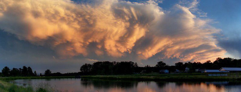
Mammatus clouds are an intriguing enigma of atmospheric fluid dynamics and cloud physics. Most typically observed on cumulonimbus anvils, Mammatus also occur on the underside of cirrus, cirrocumulus, altocumulus, altostratus, and stratocumulus, also as in contrails from jet aircraft and pyrocumulus ash clouds from volcanic eruptions.
Despite their aesthetic appearance, Mammatus are the topic of a few quantitative research studies. Observations of Mammatus are mainly obtained through serendipitous opportunities with one observing system (e.g., aircraft penetrations, visual observations, lidar, radar) or tangential observations from the field program’s other objectives.

Theories describing Mammatus remain untested, as adequate measurements for validation don’t exist due to the tiny distance scales and short time scales of Mammatus. Modeling studies of Mammatus are virtually nonexistent. As a result, relatively little is understood or known about the environment, formation mechanisms, properties, microphysics, and dynamics of Mammatus.
Who named Mammatus clouds?
The name “Mammatus” was given to these clouds by the ancient Greeks who believed they were shaped like breasts. They also called them “breast clouds”.
What causes Mammatus clouds to sink
Mammatus clouds are a rare example of a sinking cloud. Clouds sometimes have a high concentration of water droplets and ice particles which makes them heavier than the surrounding atmosphere. Because of its higher mass, the cloud sinks.
Distinctive, strange, and odd cloud formations
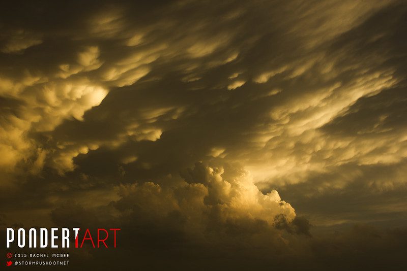
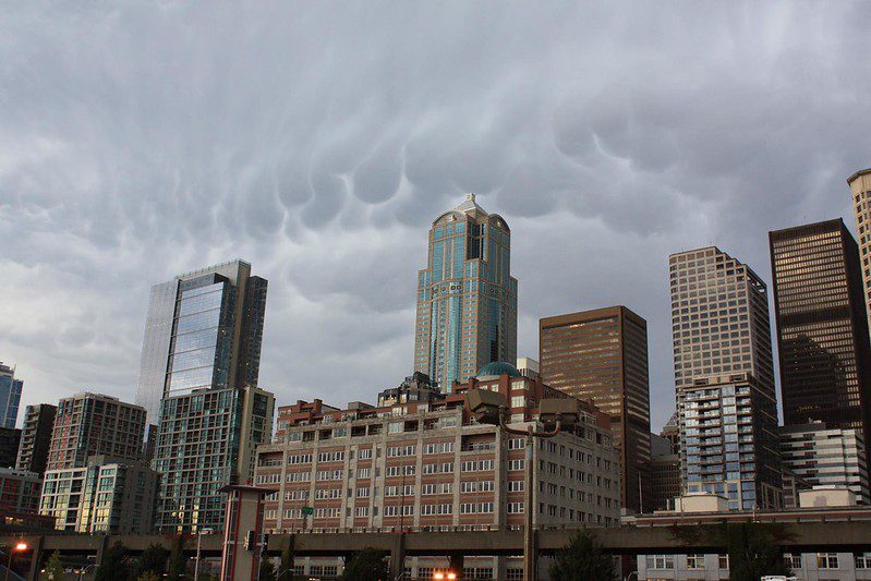
Mammatus clouds are some of the most intriguing, unusual, and distinctive cloud formations, with bulges, lobes, or pouches emerging from the base of the anvil of a cloud. The form of Mammatus formations can vary widely, from the classic protruding ball or lobe shape to a more elongated tube hanging from the cloud above.
People Also Ask
Mammatus often forms with Cumulonimbus clouds, which successively bring thunderstorms thanks to their vast, unstable air. They can also herald fine weather as they are often seen with decaying thunderstorms.
What are Mammatus clouds a sign of?
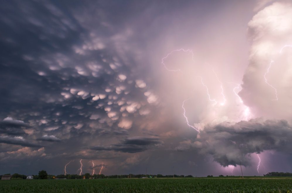
Mammatus clouds are a strange weather phenomenon that generally forms within the most unstable cumulonimbus, meaning there’s also an opportunity for hail, heavy rain, and lightning within the vicinity.
It will produce snow if the air is cold enough in the winter or the colder months. Occasionally, Mammatus may form on other cloud types, making no rain, though this is often far less common.
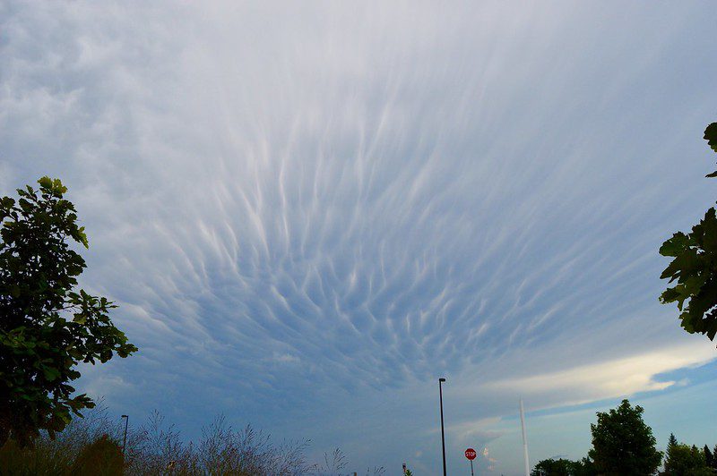
Mammatus can also indicate a decaying thunderstorm or cumulonimbus cloud, as these clouds have often been observed in dissipating thunderstorms. So these strange clouds can also mean severe weather systems that are about to break into fine or more stable weather patterns.
Mammatus comes from the Latin mamma, meaning “udder” or “breast.” The striking cloud’s appearance is most visible at sunrise or sunset or when the sun is low within the sky, and the daylight frames their pouches.
This extra feature may be a favorite for many meteorologists and cloud and photography enthusiasts.
Are Mammatus clouds dangerous?
Mammatus clouds are formed when water vapor condenses into droplets suspended in the air at high altitudes. The resulting cloud formations are usually spectacular and beautiful. They can cause aircraft turbulence and herald severe weather or decaying thunderstorms.
What clouds are associated with the Mammatus?
Mammatus usually form on the bottom of a cumulonimbus anvil. They have been observed and sighted to create or develop on other cloud types, like stratocumulus, altostratus, and altocumulus. Mammatus have also been observed to expand on the underside of volcanic ash clouds.
Are Mammatus clouds rare?
Mammatus in cumulonimbus clouds is more frequent and often a sign of a particularly powerful or tornadic storm. Mammatus clouds are uncommon clouds that form in sinking air (most clouds are formed when the air rises).
Where can you spot Mammatus clouds?
Mammatus clouds appear on the bottom of anvils that are used by thunderstorms. Their name originates from the Latin mamma word, which means “udder” or “breast.” They are pouch-like structures that protrude from beneath the anvil.
What is the rarest type of cloud?
Scientists have called noctilucent clouds “the highest, driest, coldest, and rarest clouds on Earth.” Indeed, most of the planet’s clouds form in the troposphere, the layer of atmosphere closest to the ground, and occasionally in the stratosphere. (Source: High, Dry, and Rare in the Sky – NASA Earth Observatory)
What do white fluffy clouds mean?
They indicate the formation of cumulus or cumulonimbus clouds or other cloud types in this type. These clouds can mean fine and sunny weather, rain or stormy weather, or even severe weather such as tornadoes and torrential rainfall.
Are Mammatus clouds associated with tornadoes?
Mammatus cloud refers to large, elongated, often dome-shaped clouds that form during thunderstorms. They typically appear when strong updrafts cause water vapor to condense into droplets.
These clouds may be associated with severe storms, especially hail. However, they do not necessarily indicate tornado activity but can often be seen under thunderstorms that produce tornadoes.
What causes Mammatus clouds to sink?
Mammatus clouds represent a rare example of a sinking cloud. Sometimes the cloud has a high concentration of droplets and ice particles, making it heavier that the air around it. This higher density causes the cloud to sink
7 Mammatus clouds weather facts
- Mammatus clouds are a type of cumulonimbus cloud that is often associated with severe thunderstorms.
- They are characterized by their distinct, puffy appearance, which has been likened to that of a cow’s udder.
- Mammatus clouds can occur alone or in conjunction with other cloud types, and they typically form when the air temperature suddenly drops.
- Mammatus clouds are relatively rare, but they can be found all over the world.
- In the United States, they are most commonly seen in the Midwest and Great Plains states.
- When Mammatus clouds form ahead of a thunderstorm, they can be a sign that the storm will be particularly severe.
- However, not all Mammatus clouds portend bad weather; sometimes they simply indicate that a storm is dissipating.


