Chasing the Storm: Unraveling the Science Behind Tornado Formation and the Power of Nature’s Whirlwinds
Welcome to our comprehensive Tornado Formation Guide, where we delve into the fascinating and complex world of tornadoes. As nature lovers, understanding these powerful weather phenomena is essential for both appreciation and safety.
In this guide, we will explore the intricate process of tornado formation by examining how high and low-pressure air interactions lead to vertical wind creation. Furthermore, we will discuss different types of tornadoes, such as non-supercell and supercell formations.
Additionally, you’ll learn about rating systems like the Enhanced Fujita Scale that help determine a tornado’s strength and potential damage. Finally, our Tornado Formation Guide covers monitoring techniques, including Doppler radar systems for detection as well as warning systems crucial in public safety measures.
Tornado Formation
Tornadoes are powerful, spinning columns of air that form due to the presence of both high and low-pressure air in a given space. Air particles attempt to bring these two levels into balance, creating wind that blows vertically. There are many theories surrounding tornado formation, but all begin with this basic principle.
High and Low-Pressure Air Interaction
The interaction between high and low-pressure air is crucial for the development of tornadoes. When warm, moist air rises from the ground (low pressure), it meets cooler, denser air descending from above (high pressure). This causes an imbalance in atmospheric conditions that can lead to tornado formation. The greater the difference between these two types of air masses, the more likely a tornado will develop as they try to equalize their pressures.
Vertical Wind Creation
Vertical wind shear, involving shifts in velocity or course with altitude, is necessary for tornado formation. Vertical wind shear refers to changes in wind speed or direction with height.
As warm moist air nears Earth’s surface and rises upwards, it encounters stronger winds aloft, moving at different angles than those closer down below, causing them to rotate around one another, resulting in the creation of a vortex – a key component of any potential tornadic event occurring throughout various regions worldwide where such conditions regularly exist, like the United States’ infamous “Tornado Alley.”
These vortices may then become stretched out by additional updrafts, further intensifying rotation, ultimately leading to a full-blown twister capable of wreaking havoc upon communities unfortunate enough to find themselves in the path of destruction left behind during its short-lived yet devastating existence on land before dissipating once its energy source is depleted, allowing the natural world to regain some semblance of order once more following these awe-inspiring displays of Mother Nature’s raw power.
Tornado formation is a complex process that requires the interaction of high and low-pressure air systems and vertical wind creation. By understanding these components, we can move on to explore the different types of tornadoes which form in varying ways.
Key Takeaway:
The contrast between high and low-pressure air leads to the formation of a vortex, which can be intensified by updrafts that stretch it out, culminating in an awe-inspiring tornado. This results in a vortex that can become stretched out by additional updrafts, intensifying rotation and leading to a full-blown twister capable of wreaking havoc upon communities. Tornado formation is an awe-inspiring display of Mother Nature’s raw power.
Tornado Formation: Types of Tornadoes
Understanding the different types of tornadoes is essential for nature lovers and weather enthusiasts alike. There are two main categories: supercell and non-supercell tornadoes, each with their unique formation processes.
Non-Supercell Tornado Formation Process
A non-supercell tornado forms when an updraft stretches a vertical vortex until it reaches the clouds. These types of tornadoes typically occur in weaker storm systems without the presence of a rotating mesocyclone. Some common examples include landspouts, gustnado, and waterspouts. Landspouts form over land, while waterspouts develop over bodies of water such as lakes or oceans.
- Landspout: A weak columnar vortex that occurs during thunderstorms on land.
- Gustnado: A short-lived whirlwind formed along a gust front or outflow boundary from a thunderstorm.
- Waterspout: A weak columnar vortex that occurs during thunderstorms over water surfaces like lakes or oceans.
Supercell Tornado Formation Process
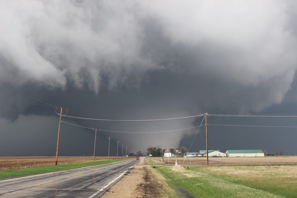
In contrast to non-supercells, supercell tornadoes form within powerful storm systems characterized by strong rotation known as mesocyclones. The process begins with an updraft lifting a rolling pipe of wind upward until it stands upright, pulling condensation from the skies into its spinning vortex.
These tornadoes are often more intense and longer-lasting than their non-supercell counterparts. The Moore, Oklahoma tornado in 2013 is an example of a devastating supercell tornado.
In both types of tornado formation, the interaction between high and low-pressure air creates vertical wind that fuels these powerful spinning columns. By understanding how each type forms, we can better appreciate the incredible forces at work within our atmosphere.
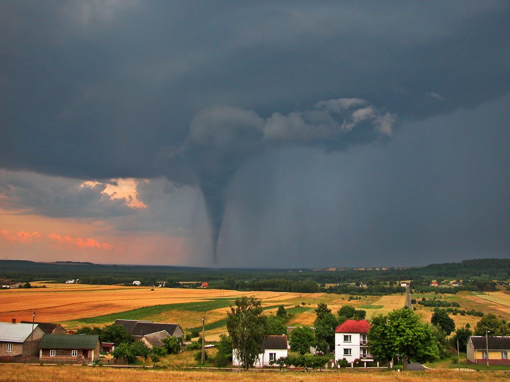
Tornadoes are classified into two types, non-supercell and supercell tornadoes. Understanding the formation process of each type can help us better prepare for them in the future. Next, we will look at how to rate tornado strengths using the Enhanced Fujita Scale and explore their effects on their surroundings.
Rating and Strengths
Tornadoes are notorious for their devastating force, yet the magnitude of each tornado varies. The strength of a tornado is rated on the Enhanced Fujita (EF) scale, which ranges from EF0 to EF5. This section will discuss how the Enhanced Fujita Scale works and the effects and damages caused by different ratings.
Enhanced Fujita Scale Explained
The Enhanced Fujita Scale was developed in 2007 as an improvement over the original Fujita scale, which was introduced in 1971 by Dr. Tetsuya Theodore “Ted” Fujita. The new scale accounts for more variables, such as building materials and construction quality, when determining a tornado’s rating based on observed damage.
The EF scale consists of six levels:
- EF0: Minor damage with winds between 65-85 mph
- EF1: Moderate damage with winds between 86-110 mph
- EF2: Significant damage with winds between 111-135 mph
- EF3: Severe damage with winds between 136-165 mph
- EF4: Devastating damage with winds between 166-200 mph
- EF5: Incredible damage with winds exceeding 200 mph
An EF5 rating represents extreme damage potential, making tornadoes at this level one of nature’s most destructive forces. These tornadoes can cause catastrophic damage to communities within their path, leveling entire neighborhoods and leaving behind a trail of devastation.
Effects and Damages Caused by Different Ratings
The severity of the damages caused by a tornado depends on its rating on the Enhanced Fujita Scale. Here are some examples of what each rating level might look like in terms of destruction:
- EF0: Light damage such as broken tree branches, minor roof damage, or damaged gutters
- EF1: Moderate damage, including broken windows, damaged roofs, or overturned mobile homes
- EF2: Significant damage with roofs torn off houses, large trees uprooted, and cars lifted off the ground
- EF3: Severe damage, including entire stories of well-constructed houses destroyed, trains overturned, and large trees debarked
- EF4: Devastating damage with entire houses leveled, cars thrown significant distances, and debris scattered for miles
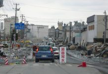
- EF5: Incredible damage where even well-built homes can be swept completely off their foundation and carried great distances before disintegrating into rubble. In extreme cases, concrete structures may even be damaged or partially disintegrated.
Understanding the different ratings on the Enhanced Fujita scale helps us appreciate the varying intensity of tornadoes and their potential for destruction. This knowledge can also help us better prepare for and respond to tornado threats in order to minimize damage and safeguard lives.
It is important to understand the Enhanced Fujita Scale and its effects on tornadoes in order to prepare for potential disasters. By monitoring these storms with Doppler radar systems, we can be better equipped to forecast them and take necessary safety measures.
Key Takeaway:
The Enhanced Fujita Scale rates tornadoes based on their observed damage, with ratings ranging from EF0 to EF5. The higher the rating, the more ruinous and destructive a tornado can be, potentially causing catastrophic harm to towns in its wake. Understanding these ratings can help us better prepare for and respond to tornado threats in order to minimize damage and safeguard lives.
Monitoring & Forecasting Techniques
Meteorologists play an essential role in monitoring storm fronts in high-risk areas for possible tornadic events. They use advanced technology, such as Doppler radar systems, which help track storm movement patterns and provide valuable information on tornado formation. This data allows meteorologists to issue warnings or advisories aimed at mitigating potential damage faced by nearby communities, ensuring public safety remains paramount during these natural disaster occurrences throughout affected regions worldwide.
Doppler Radar Systems in Tornado Detection
Doppler radar systems are a crucial tool for detecting the early signs of tornado formation. These sophisticated instruments measure the speed and direction of precipitation within a storm system, allowing meteorologists to identify rotation patterns indicative of developing tornadoes. By analyzing this data, experts can determine if conditions are favorable for tornadic activity and take appropriate action to alert those who may be impacted.
- Dual-Polarization Technology: Modern Doppler radars employ dual-polarization technology that simultaneously sends horizontal and vertical pulses. This advancement provides more detailed information about the size, shape, and composition of precipitation particles within a storm cell – vital clues when determining whether a funnel cloud is forming.
- Rapid Scanning Capabilities: The ability to rapidly scan multiple elevations enables Doppler radars to create three-dimensional images of ongoing weather events quickly. These comprehensive views allow meteorologists to detect changes in wind velocity associated with rotating updrafts – another key indicator that a tornado may be imminent.
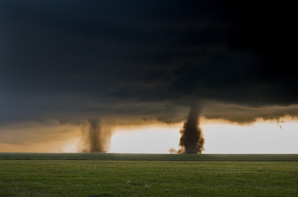
Warning Systems and Public Safety Measures
Once a potential tornado has been identified, meteorologists work closely with local authorities to implement public safety measures. These efforts are designed to minimize the impact of these destructive natural phenomena on communities within their path.
- Tornado Watches: When conditions are favorable for tornado formation, the National Weather Service (NWS) issues a Tornado Watch. This advisory encourages residents in affected areas to remain vigilant and prepared for rapidly changing weather conditions.
- Tornado Warnings: If radar data or trained storm spotters confirm that a tornado is imminent or already occurring, the NWS will issue a Tornado Warning. At this point, those in the warning area should immediately seek shelter in an interior room on the lowest level of their home or building.
- Siren Systems & Emergency Alerts: Many communities have outdoor siren systems that sound when a Tornado Warning is issued. Additionally, emergency alerts can be sent directly to smartphones through Wireless Emergency Alerts (WEA). This ensures that residents receive timely information about impending threats, even if they’re away from television or radio broadcasts.
In addition to these official warnings and alerts, individuals can take proactive steps by staying informed about local weather forecasts during severe weather seasons and having an emergency plan in place should tornadic activity threaten their community.
Key Takeaway:
Meteorologists use advanced technology, such as Doppler radar systems, to monitor storm fronts in high-risk areas for possible tornadic events. They issue warnings or advisories aimed at mitigating potential damage faced by nearby communities and work closely with local authorities to implement public safety measures when a potential tornado has been identified. Dual-polarization technology and rapid scanning capabilities of modern Doppler radars provide more detailed information about the size, shape, and composition of precipitation particles within a storm cell – vital clues when determining whether a funnel cloud is forming.
FAQs Concerning Tornado Formation Guide
How is a Tornado Formed? Step by Step?
Tornado formation involves several steps:
- Warm, moist air near the ground rises and creates an updraft.
- Cooler air above sinks, forming a downdraft.
- Wind shear causes horizontal rotation in the atmosphere.
- The updraft tilts this rotating column of air vertically, creating a mesocyclone within a supercell thunderstorm.
- Finally, when the mesocyclone reaches the ground, it becomes a tornado.
What are the Four Steps of Tornado Formation?
The four key steps in tornado formation are:
- Updrafts form as warm air rises.
- Downdrafts develop from sinking cool air.
- The horizontal rotation occurs due to wind shear.
- Vertical rotation develops into a mesocyclone that eventually touches down as a tornado.
How Do You Prepare for a Tornado?
To prepare for a tornado, follow these guidelines:
- Create an emergency plan with your family or community members.
- Identify safe shelter locations such as basements or interior rooms without windows.
- Assemble an emergency kit.
- Stay informed about weather conditions through local news sources or NOAA Weather Radio alerts.
- Practice your emergency plan regularly.
What are the Three Stages of Tornado Formation?
The three main stages of tornado formation include:
- Development (updrafts and downdrafts interact).
- Maturation (mesocyclone forms within supercell thunderstorm).
- Dissipation (tornado weakens due to lack of energy).
These stages can vary depending on factors like atmospheric conditions and storm structure.
Conclusion
In conclusion, understanding the formation of tornadoes is crucial for nature lovers and those living in areas prone to severe weather. The interaction between high and low-pressure air creates vertical wind that can lead to both non-supercell and supercell tornadoes. By knowing the different types of tornadoes and their ratings on the Enhanced Fujita Scale, individuals can better prepare for potential effects and damages caused by these natural disasters.
Monitoring techniques such as Doppler radar systems aid in detecting tornadoes, while warning systems help ensure public safety measures are taken. With this Tornado Formation Guide, readers have gained valuable knowledge about how these powerful storms form and how they can stay safe during them.


