Weather forecast for Gold Coast, Brisbane, Sunshine Coast, Gympie, Bundaberg, Maryborough, Rockhampton, Gladstone:
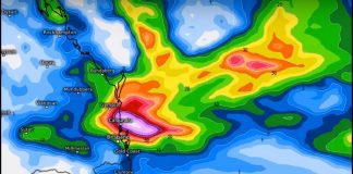
Some nice winter rain on the way Over the next few days until around Sunday morning, central and southern Queensland will experience an increase in showers about the inland and coastal areas.
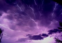
From late Saturday(03/07) into early Sunday, it should peak with some heavier falls and thunderstorms developing. We may receive some good falls out of this system as it approaches the eastern half of Queensland.
General falls of 30mm with some isolated pockets receiving over 90mm over a 4 day period. Areas to the west of the coast may get some heavier rain areas as well as parts of the coastal strip.
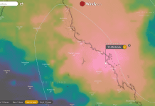
This is great winter rain and needed for some parts of Queensland. Visit my weather centre for live radar, winds, temperatures and other weather tools. Don’t forget to bookmark the page 🙂 Queensland Fire and Emergency Services advise that people should:
* Move your car under cover or away from trees.
* Secure loose outdoor items.
* Never drive, walk or ride through floodwaters. If it’s flooded, forget it.
* Seek shelter, preferably indoors and never under trees.
* Avoid using the telephone during a thunderstorm.
* Beware of fallen trees and powerlines.
* For emergency assistance contact the SES on 132 500.

- Please keep an eye on the Bureau of Meteorology Brisbane Weather radar for live storm updates.
- Also, keep an eye on the weather warnings page for Queensland.
- Be prepared for severe thunderstorms this season. Read the Bureau of Meteorology’s Preparation and safety during thunderstorms
Weather Maps and Tools
- Queensland Live Weather & Lightning Radar Map
- Queensland Live Wind & Gusts Radar Map
- Queensland Live Temperature Map
- Queensland Waves & Swells Map
For further information and live updates about Queensland weather forecasts visit:
- https://www.facebook.com/HigginsStormChasing/
- https://www.facebook.com/ozcyclonechasers
- https://www.facebook.com/SevereWeatherAustralia/
- https://www.facebook.com/seqweather
- https://www.facebook.com/BrisbaneCityWeather
- https://www.facebook.com/Tims-Severe-Weather-Queensland-100157335236883/
Weather forecasts for Queensland: Gold Coast, Brisbane, Sunshine Coast, Gympie, Bundaberg, Maryborough, Rockhampton, Gladstone, Mackay, Cairns all other regional centres. Our forecasts include long term and short term forecasts as well as significant and severe weather events affecting the regions.


